Kangchenjunga
The Five Great Treasures Revealed
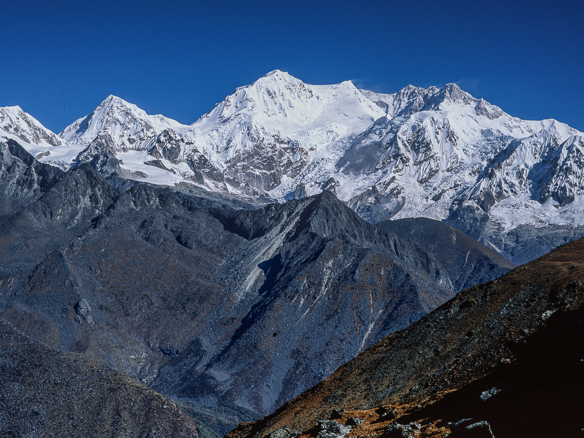
Bounded in the west by the Tamur River, in the north by the Lhonak Chu and Jongsang La, and in the east by the Teesta River, this great mountain massif stands both in Nepal and the state of Sikkim. The main summit and its satellites encompass 16 peaks over 7,000 metres (23,000 ft.). The main ridge of the massif runs from north-northeast to south-southwest and together with ridges running roughly from east to west they form a giant cross.
These ridges contain a host of peaks over 6,000 metres (19,685 ft.) in height. The western ridge culminates in the striking outlying peak of Kumbhakarna, also known as Jannu, 7,710m.,( 25,300 ft.). The northern section includes Yalung Kang, Kangchenjunga Central and South, Kangbachen, Kirat Chuli, and Gimmigela Chuli, and runs up to the Jongsang La. The eastern ridge in Sikkim includes the handsome if smaller summit of Siniolchu, 6,888m., (22,598 ft.), whilst the southern section which includes Kabru runs southwards along the Singalila Ridge and the Nepal-Sikkim border.
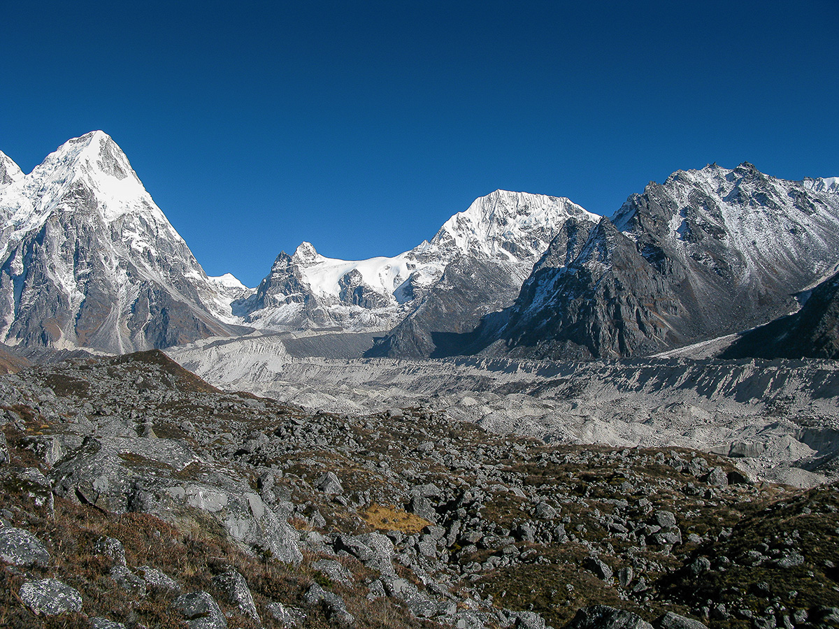
Four main glaciers radiate from the main peak; the Zemu glacier in the northeast and the Talung glacier in the southeast drain to the Teesta River; the Yalung glacier in the southwest and the Kangchenjunga glacier in the northwest drain to the Arun and Kosi rivers. These glaciers spread over the area above approximately 5,000 metres and the glaciated area covers about 314 square kilometres in total.
The mountain’s eastern aspect was, however, a familiar sight to visitors to Darjeeling and until 1849 Kangchenjunga was thought to be the highest mountain in the world. Early attempts to climb Kangchenjunga were made from Sikkim to the east, but the more recent activity has been on the Nepalese side. British climbers have played a significant role in the climbing history of the mountain; Joe Brown and George Band made the first ascent from the south via the Yalung Glacier in 1955 and then Doug Scott, Peter Boardman and Joe Tasker made the first oxygen free ascent from the Kangchenjunga Glacier to the north-west in 1979.
These two climbs were the inspiration for a small expedition I led whose objective was to explore and photograph the Yalung and Kangchenjunga Glacier systems. The absence of detailed and accurate maps made route planning difficult but the aim of the trip was to approach the mountain from the south via Phidim, cross the 5,350 metre Lapsang Pass to return along the Ghunsa valley and Milke Danda ridge to Basantpur.
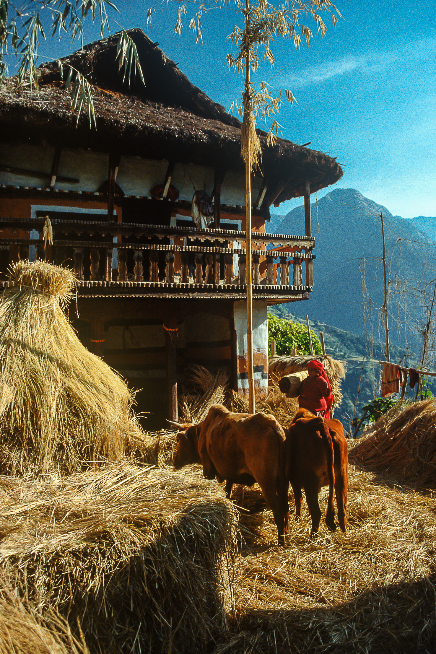
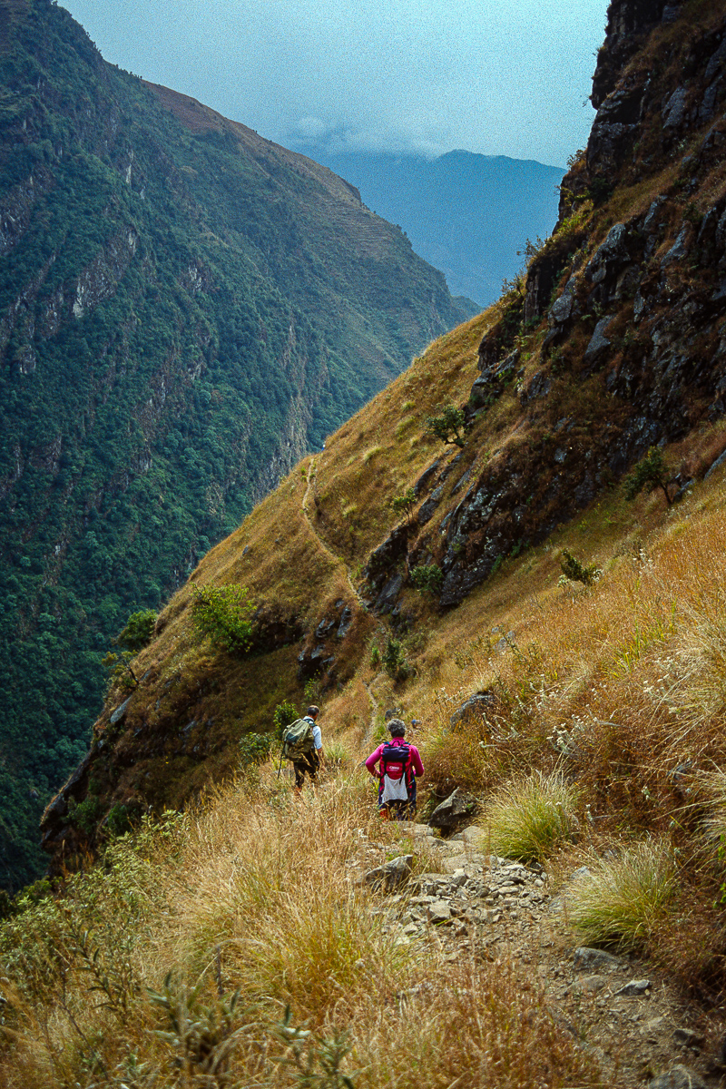
In contrast, beyond Phidim, the first days on foot followed a peaceful trail which meandered its way through sub-tropical forest, tiny settlements and terraced paddy fields above the tributaries of the Tamur River. The local people, who were mainly Rais and Limbus always welcomed us into their villages; the children were fascinated by our cameras and other western paraphernalia and they occasionally asked us to read to them from their English language schoolbooks.
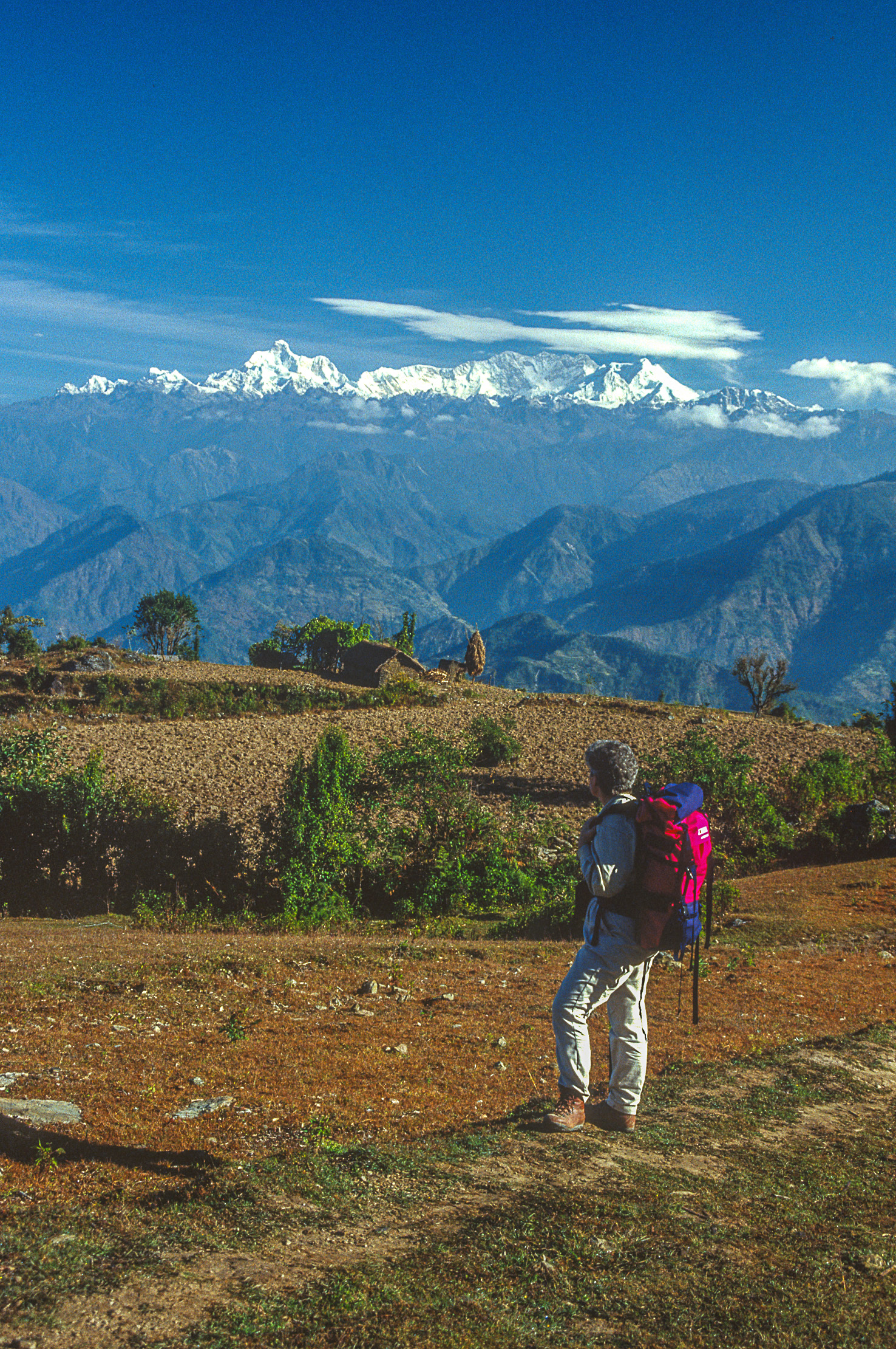
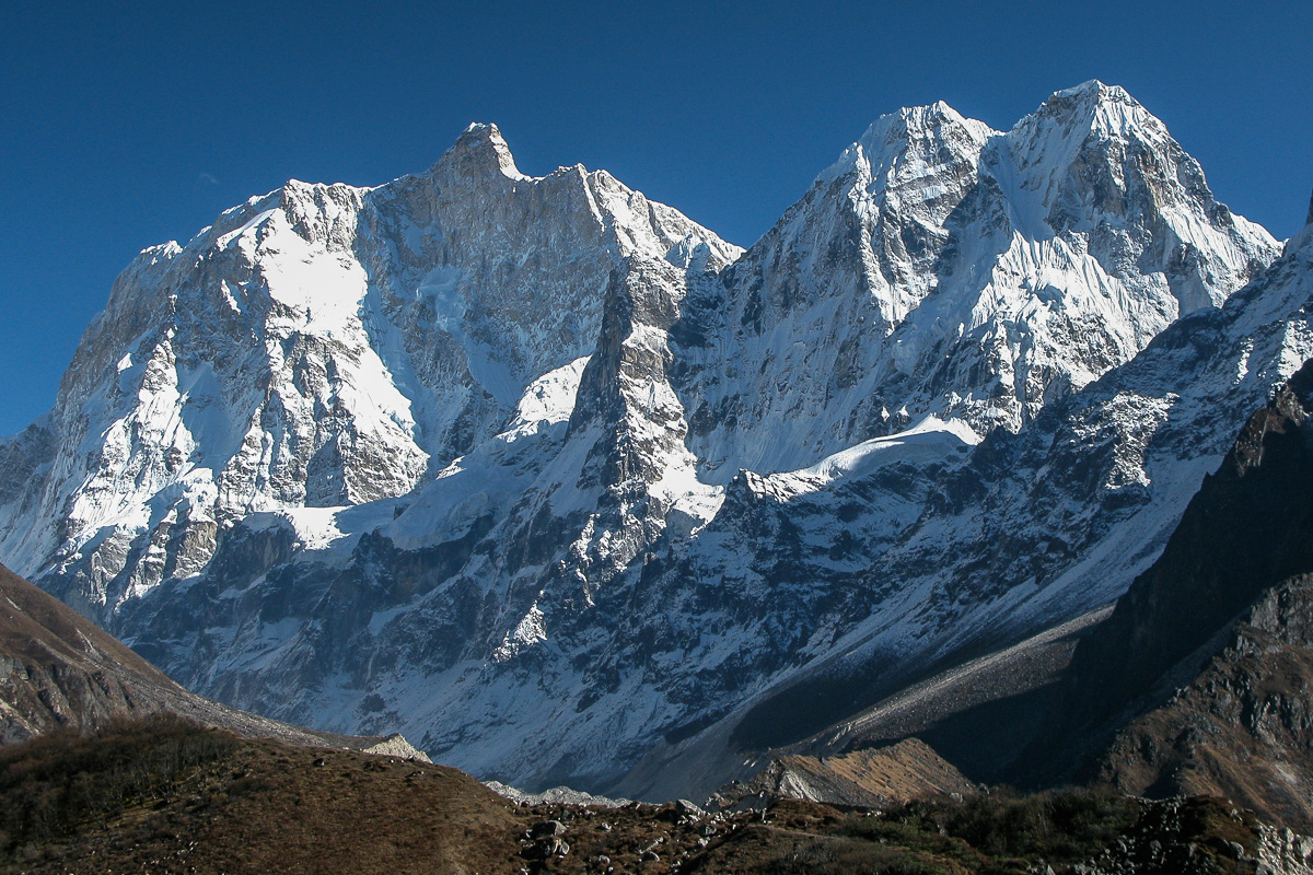
Upon reaching the crest of the first major ridge on route at the village of Ghopetar we obtained the first unobstructed view of our objective. Fifty miles away, rising like a cluster of diamonds against a deep blue sky, was the whole Kangchenjunga massif; on its western flank the striking peak of Jannu captured much of our attention in favour of its loftier neighbours.
We left the valley over the 3,310 metre Lasiya Bhanjyang and then descended and followed the trail along the bank of Simbua Khola river to its source at the snout of the Yalung Glacier. With increasing altitude the valley opened out and the forest was reduced to rhododendron thickets; the view ahead improved and was dominated by the great ice wall of Kabru, 7,353m., (24,125 ft.).
Lapsang, 4,432 metres, was the first of many idyllic grassy campsite locations we came upon over the trip. The trail between Lapsang and our top camp at Rhamze, 4,560 metres, was a sheer delight as the mountains ahead rose in stature with every step we took. Tiny stone monuments and glacial lakes provided foreground for photography of the surrounding peaks, the most stunning of which was Rathong, 6,678m., (21,910 ft.), whose form was so reminiscent of the Khumbu giant Pumori.
We stopped beside a small stone shrine on the lateral moraine and, following the example of our Sirdar Sonam Chotter and Sherpa Ang Nima, who lit a small juniper fire, we gave thanks for the success of our trip and left small offerings of money and food. Upon our return to Rhamze our thoughts turned to the task ahead, the crossing of the Lapsang La pass.
The Yalung and Kangchenjunga valley systems are separated by a long ridge that runs south west from Jannu for some twenty miles. To link the two valleys without returning to their confluence at Hellok it is necessary to make one of two pass crossings, the Mirgin-Sinion La or the much higher Lapsang La. In anticipation of obtaining closer views of Jannu from the foot of the Yamatari Glacier we chose the more challenging Lapsang La, but did so with only limited information about its height and of the terrain we were likely to encounter.
We left camp in confident mood; fit, well acclimatised and in the belief that it would not take long to reach the pass. The reality turned out to be very different as we struggled for four hours to complete the 1,000 metre climb. The entire ascent was over glacial debris comprised of sand, scree and sharp angular blocks of varying size and stability.
The view from the summit of the pass, at about 5,350 metres, was disappointing. The mountains to the east remained clear, but the clouds enveloping Everest and Makalu to the west heralded a change in the weather. We hurried off down, initially across easy angled snowfields that provided temporary relief, but then back onto the interminable moraine. Three hours later we reached camp located on a soft grassy bank at Lumba Sumba Kharka. The sherpas, bless them, had camp ready and greeted us with mugfulls of hot sweet tea.
The next morning it was snowing and the cloud that covered the surrounding peaks denied us our planned close and dramatic view of Jannu from the Yamatari Glacier. However, our consolation was a short and easy walk through pine and rhododendron forests to meet the main valley at Ghunsa. The inhabitants of Ghunsa are of Tibetan origin, and the cattle grazing in the open fields, the mani walls, chortens and the small monastery were once again reminiscent of the Khumbu.
Our final objective was to reach Pangpema, base camp for expeditions climbing Kangchenjunga from this side. The easy trail between Lhonak and Pangpema rose steadily along the grass covered lateral moraine, rising high above the rubble covered glacier several hundred feet below. Kangchenjunga’s summit only revealed itself on the very last stage of the walk to Pangpema, much of the time it was hidden behind Wedge Peak, 6,750m., (22,147 ft.), a bold mountain whose summit ridge was comprised of intricately carved ice flutings.
Pangpema was little more than a grassy shelf above the glacier; a solitary boulder in full view of the summit supported a plaque in memory of the American climber Chris Chandler who died on Kangchenjunga in 1985.
From the grey rubble of the glacier the north faces of Kangchenjunga and Yalung Kang rose up over 3,500 metres in a series of tiers. Each hanging glacier was separated from the next by ice cliffs in a pattern seemingly designed to deter climbers. Whilst Kangchenjunga attracted most of our attention, the supporting summits of Nepal Peak, Tent Peak, Pyramid Peak and The Twins added much to the magnificence of our surroundings.
We had planned to make the return journey to Basantpur as interesting as possible by walking along the Milke Danda, a great ridge separating the Arun and Tamur valley systems. We climbed the 1,500 metres to the ridge top at a fairly relaxed pace, frequently stopping at chautaras in the shade of a Banyan and Pipal trees to enjoy sweet, juicy and locally grown oranges. Rhododendron forest replaced paddy fields and the villages became more scattered as the altitude increased.
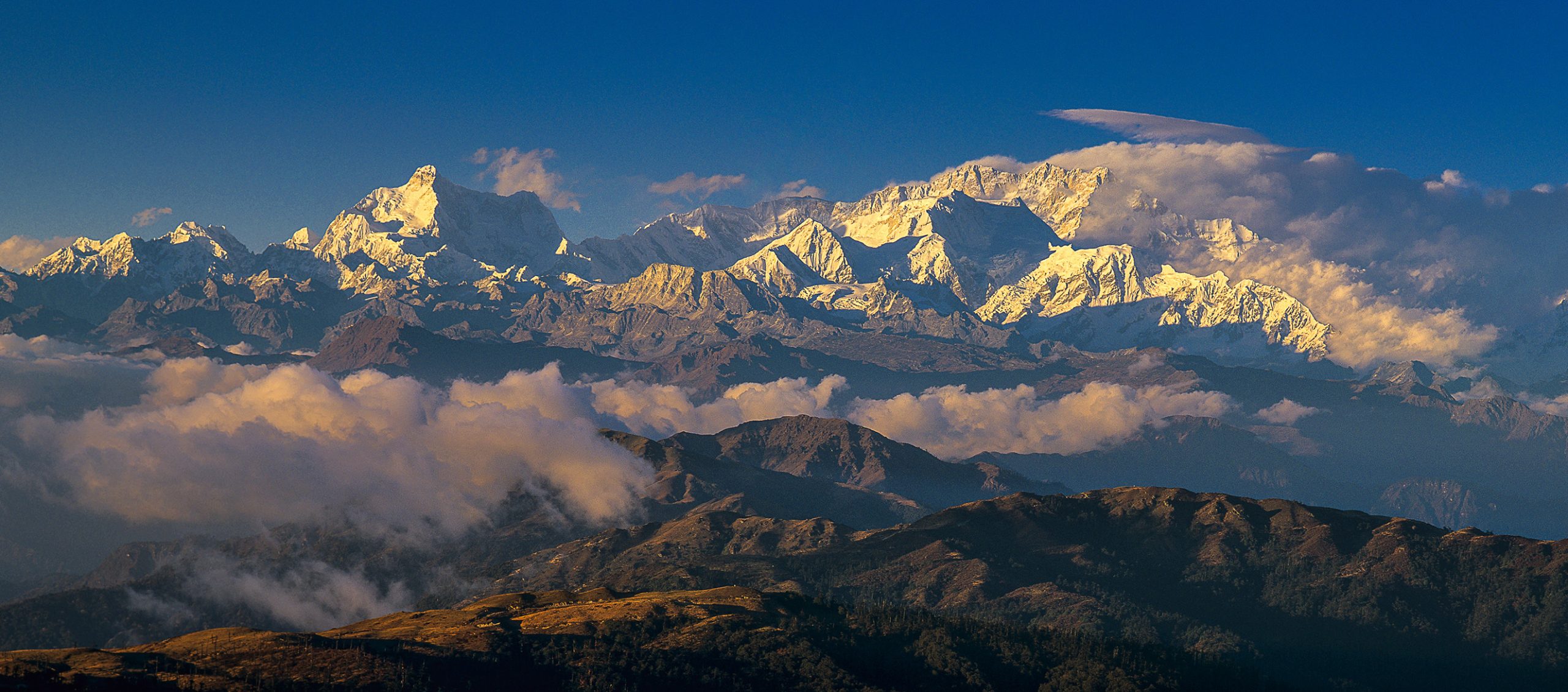
At the top of the Milke Danda the tiny village of Gupha Pokhari is blessed with a 180 degree panorama of the Himalaya. On the western side of the ridge it included Chamlang, Lhotse, Everest and Makalu, whilst to the east were the Kangchenjunga massif and peaks in Sikkim. The view was our constant companion for the last few days of our trek as we walked through grassy meadows along the wide and level ridge. At each sunrise and sunset we found a suitable vantage point to watch the world’s highest mountains unfold their colourful spectacle.
On the morning of our departure from Basantpur we boarded the bus with mixed emotions; looking forward to the comforts of home yet sad to come to the end of a happy and successful adventure. There are so many highlights on this route to Kangchenjunga that it is difficult to single any one out. The majesty of the high peaks fulfilled all expectations, but for me the lasting memory is of the diversity of the country through which we passed and the welcome that we received from its people.
