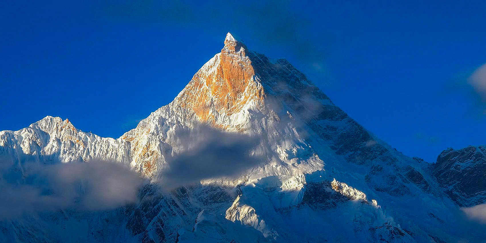
Makalu from the Barun Glacier

Makalu

East of Everest

MAKALU, 8,485 metres (27,838 ft), is the fifth highest mountain in the world and is located in the Mahalangur Himalayas, 19 km south-east of Mount Everest on the border between Nepal and Tibet. In common with its neighbour Everest, Makalu is regarded as belonging to the Khumbu Himal, but unlike other mountains of that area its valleys drain entirely into the Arun river to the east rather than into the Dudh Kosi to the west.

Furthermore, unlike Everest and the other mountains of the Khumbu Himalaya that are reached by routes through the valley of the Dudh Khosi River and its tributaries, the best approach to Makalu is from the Arun Valley to the east. This lengthy approach also requires a crossing of the 4,127 metre Shipton Pass followed by the steady ascent of the remote and isolated Barun Valley to the Barun Glacier at the foot of the mountain’s magnificent south face.

The final objective was almost in sight. I took a momentary glance back down towards the rubble of the lower Barun Glacier and then pressed on towards the small col above. I struggled for every breath, cursing my clumsy body for not keeping pace with my mental impatience. Slowly the ground ahead levelled out and then, from behind a ridge, Makalu finally appeared. 

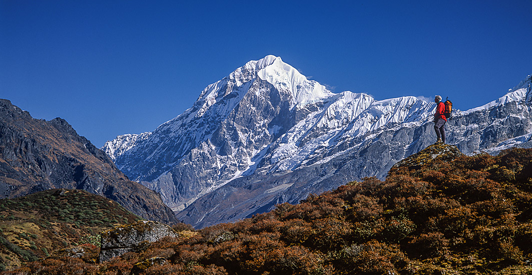
The world’s fifth highest mountain and one of the truly great peaks of the Himalaya, stood in proud isolation; its steep flanks of pink granite sweeping up from beautiful valleys and complex glacier systems. Comforted by the warmth of the bright morning sun, I sat to relax beside a glacial lake at the foot of Makalu’s great south face. There I reflected upon the long and challenging journey upon which I had embarked and which had brought me to this incredible place. 

Our approach to the area had been from Hille; a bustling hill village that we reached in a single day from Kathmandu by taking the daily flight to Biratnagar and then driving overland through the hill towns of Dharan and Dhankhuta. An alternative start to the trip would have been to use the direct flight from Kathmandu to the STOL airstrip beside the sprawling village of Tumlingtar, but as the schedule is unreliable I must admit that I preferred the traditional overland approach.

My most vivid memories of the trail out of Hille include stimulating views of the main Himalayan crest over seventy miles away; cold, distant and ethereal, their sparkling summits appeared detached from the great maze of intervening ridges. 

Typical farmhouse of the Arun Valley
The old bridge over the Arun River at Num
The Shipton La Pass

The trail from Hille soon descended into the base of the Arun valley where it winds its way along the terraces of rice paddies and between a network of fields containing mustard, sugar cane and sunflower. In the windless confines of the river valley the sun’s rays reflected off the sandy shores and the temperature and humidity rose oppressively. The local people, mainly Rais, Chetris and Limbus, were always extremely cheerful and friendly as I took advantage of the shelter provided by their small timber verandas; their greeting was often accompanied with gifts of bananas, oranges and handfuls of toasted soya bean. 

After two days’ walking the trail then climbed a ridge above the east bank of the river and entered Khandbari, the last major village in the entire walk in and the only opportunity to top up those vital supplies. 

The next few days were a delight; easy walking along a level forested ridge with comfortable temperatures and excellent campsites. If encouragement was needed then the objective was often in sight; Makalu rises high above all other peaks on the northern horizon, unchallenged by Everest or its attendant peaks that are hidden from view by Chamlang’s long icy crest. 

Himalayan trails rarely stay level for long and beyond Mude village this one plunges two thousand feet to a bridge across the mighty Arun river at Num. The structure we encountered was comprised of just a single plank sparingly supported by rusty wire ties to two steel cables; its 150 foot span was just long enough to make one feel very vulnerable threatening to despatch its victim forever into the roaring icy waters below. 

Leaving the Arun far below the trail now began its ascent towards the 4,100 metre Shipton La pass which provides access to the Barun valley. As the elevation increased the sub-tropical vegetation gave way to rhododendron forest and habitation becomes scarce and more primitive. The Sherpa village of Tashigaon is the very last on route and, as if in anticipation of the dangers ahead, it is blessed with one of the finest mani walls that I have ever seen on my travels to Nepal. The 1,500 metre ascent from Tashigaon to the pass took two days; the faint path climbed through the forest before gaining a delightful ridge which separates the Iswa and Barun valleys.

The Shipton La is a series of easy angled snowy ridges and basins containing three charming lakes. Upon the highest of these ridges, with a view of Chamlang and Makalu, a cairn and prayer flags have been erected. Regrettably, little time can be spent enjoying them for the distance between campsites on each side of the pass occupies a long day’s walk. 

There is a steep descent on the northern side of the pass through a valley which is densely filled with rhododendron bushes. Eventually the trail turns westward and follows the course of the Barun Khola, the river draining the snout of the Barun Glacier beneath Makalu itself. The steep lower slopes of the Barun valley are built of unstable glacial till and sections of the tiny path are often washed away during the monsoon. At one point I found myself scampering across a steep sandy slope as rocks came rolling down from above. Fortunately the difficulties did not last for long. 

The shepherds' hut at Nebe Kharka
Camp beneath Peak 6 also known as Tutse
Chamlang from the Lower Barun Glacier

The valley soon widens and is filled with pine forest; lichen covers the rocks and trees. Idyllically situated in a small clearing beside the river at Nebe Kharka is the wooden hut which provides the only permanent shelter in the lower valley. It is a superb location for a campsite, possessing all the characteristics and qualities expected when trekking in Nepal. Aspects of the situation invade all the senses; the smell of pine and the sound of the tumbling river become as significant a part of the whole Himalayan experience as the sight of the great peaks themselves. 

Beyond Nebe Kharka the peaks of the Lower Barun Glacier finally came into view, although Makalu was hidden to the north and remained so until base camp is reached. In the absence of any habitation, most of the peaks do not have a local name and are known purely by a survey number or characteristics of their appearance. 

Chamlang was one obvious exception along with Tutse (or Peak 6), an icy spire rising to 6,700 metres (21,983 ft.) above cliffs rivalling those of Yosemite. The rock debris all around provided an insight into the enormous natural forces that have formed these great mountains; highly micacious rocks were embedded with garnets and other interesting minerals.

This unique landscape shelters some of the last pristine mountain ecosystems on earth; rare species of animals and plants flourish in diverse climates and habitats, relatively undisturbed by the passage of the limited number of climbers who pass this way.

Reaching the snout of the Lower Barun Glacier was a landmark in itself, and I ascended a ridge above the lateral moraine to look across it. Beyond several miles of this river of rubble I could see the icefall where the glacier tumbled out of its snowy upper basin. A further 1,200 metres higher but out of sight was the famous West Col, the key to the route into the remote Hongu valley and subsequently over the Mingbo La to Thyangboche and the Everest region.

High mountains rise up in all directions. In addition to the main peak, Makalu has two notable subsidiary peaks and several striking neighbours of either 7,000 or 6,000 metres. Kangchungtse, or Makalu 2, 7,678m., (25,192 ft.) stands about 3 km north-northwest of the main summit, and Chomo Lonzo, 7,804m., (25,604 ft.) 5 km north-east across a broad plateau, but sadly out of sight from the glacier below. 

Two miles beyond, on a small strip of grass beside an alluvial plain stand the remains of two small huts; this was Shershon, 4,750 metres, a good place to use as a base for further exploration of the region. Shershon stands at the junction of the Barun and Lower Barun valleys, completely circled by peaks built of massive rock buttresses, hanging glaciers and tumbling icefalls. 

It is a spectacularly beautiful setting but as I walked into camp that day the afternoon cloud had already rolled in and the site seemed just about the bleakest spot on earth. Then quite suddenly, in a gesture almost designed to lift flagging spirits, the clouds parted to reveal the very summit of Makalu bathed in a delicate pink light. There was no time to snatch a photograph as the clouds closed in as quickly as they had parted; it was one of those magical moments that must remain as a personal and private memory of the trip.


Lhotse and Everest beyond from the head of the Barun Glacier.
The great South Face of Makalu from the Barun Glacier just below Base Camp, Prints of Everest and The Himalayas

I was very anxious as I settled into my sleeping bag that evening for only one day remained before I had to begin the return journey; if only the morning would be clear so as let me enjoy that close look at the giant. I tossed and turned for most of the night; the long and lonely periods of eerie silence were punctuated only by the sound of avalanches crashing down off Tutse. It was late into the night before I drifted into slumber.

I awoke abruptly to find that it was already daylight and I hurriedly scrambled out of the tent to pack my gear. The day had dawned clear, but high cloud on a westerly wind and particles of ice in the air foretold a change in the weather. There was no time to waste. I unceremoniously gulped a mug of tea and a few mouthfulls of rice pudding so carefully prepared by our sherpas and set off on the final 150 metre climb towards Base Camp, just three miles from Makalu’s summit itself.

For once my luck held, and when I reached Base Camp the cloud had dissolved into a clear blue sky. I had an unobstructed view of the entire mountain; Makalu stood tall, cold and uncompromising. I felt inadequate; how insignificant are the achievements of mankind in relation to the wonders of nature; such beauty and on such a scale.

When I finally turned my back on Makalu and headed for home, I could not help thinking how utterly unpredictable life can be. My decision to go to Makalu was a last minute one forced upon me following the refusal of the Nepalese authorities to grant a permit for a planned trip to Kangchenjunga. On reflection I must thank them for introducing me to a region that I would otherwise have neglected yet which provided a thoroughly fulfilling and rewarding experience.